Our itinerary was as follows:
27/08/2011
0730 - 1300 Bus ride from Bergen to Stavanger (http://www.kystbussen.no/)
1300 - 1430 Walk around the city centre and harbor
1430 - 1800 Fjord Cruise along Lysefjord (http://www.rodne.no/index.cfm?id=325701)
1800 - 1900 Check in Hotel (http://www.parkinn.com/hotel-stavanger)
1900 - 2000 Bought dinner at REMA 1000 and had dinner in our rooms
28/08/2011
0700 - 0730 Breakfast at the Hotel
0730 - 0800 Walk to ferry terminal
0800 - 0840 Ferry from Stavanger to Tau
0840 - 0940 Bus from Tau to Preikestolen Carpark
0940 - 1445 Hike up Preikestolen
1445 - 1515 Rest
1515 - 1615 Bus from Preikestolen Carpark to Tau
1615 - 1755 Ferry from Tau to Stavanger
1755 - 1845 Hot Coffee and rest at tourist info centre
1845 - 2330 Bus from Stavanger to Bergen
2330 - 0000 Public bus from Bergen city centre to Hatleberg Student Hostel
Stavanger
Stavanger is the fourth largest city of Norway with a population of 117 315 (January 1, 2007). It is located in the South-western part of Norway.
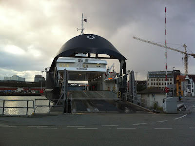
The bus trip to stavanger involves 2 ferry rides each way. The ferry rides were a new experience for me as I have never taken such a ferry in my life. The hull of the ferry opened up and our bus entered, parked and we disembarked and retreated to the comfort of the passenger deck. The passenger deck is like one big restaurant with my seats (food court style).
One thing can be said about the transport system in Norway, It's very punctual! we arrived at 1300 on the dot.
Here is the stavanger city centre:
The two red dots on the map was where we took the cruise and the ferry to tau.
Rodne Fjord Cruise
The things we saw on the cruise:
- Lysefjord
- Preikestolen
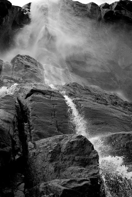
- Waterfall
- Mountain goats
- Seals (didn't see any)
The journey to the fjord was a long one. (See the map below) The speed of the boat was fast which made it very cold. Nonetheless, we stood at the front of the boat to get the best view of the journey into the fjord. (I'm glad for my Ultimo jacket!)
Pictures of the Preikestolen
Pictures of the waterfall
Pictures of the mountain goats
Hike to Preikestolen
Getting there:
Red Line - Ferry from Stavanger to Tau
Blue Line - Bus from Tau to Preikestolen Carpark
Orange Line - Hike from Carpark to Preikestolen
What is Preikestolen?
Preikestolen (Pulpit Rock) is a huge cliff 604 m above the Lysefjord and opposite the Kejrag (Boulder rock). The top of the cliff is approximately 25 by 25 m and almost flat.
Photo from wikipedia
Hiking Route to Preikestolen
It takes approximately 2 hours to ascend and 2 hours to descend. There are 2 segments of the route that are quite challenging. The beginning 0.5km and half way 1.5km - 2km. Some parts you have to climb on rocks. In addition, we had to be careful as for most parts, there were no railings or fences. One wrong move and it would have ended for us.
The weather at Preikestolen changes very quickly. I'm thankful that I wore a good pair of hiking shoes, quick drying pants and a water proof jacket. (Bringing a pair of gloves might be a good idea) While we were ascending, it was sunny and I had to take off my jacket as it was getting warm. However, towards the end, it started raining. The strong winds made matters worse. It was freezing up there. And we couldn't see the lysefjord when it started raining more heavily. We had no choice but to make our descend earlier than we had planned to. Nevertheless, the view was awesome for most parts of the hike up.
Here are some of the photos of our hike:
The tiring journey up...
The tiring journey up...
Some rest...
New found friends...
Other hikers...
Awesome view from the halfway point...
More climbing...
A signboard to point us in the right direction...
The view near the top... Almost there...
Magnificent Lysefjord...
Finally!!! Preikestolen!!!
The journey home is a tiring one...
Back to base camp (tourist info centre)
Mission accomplished!


did you manage to see the northern lights??
ReplyDelete